

TreeFitty
-
Content Count
5858 -
Joined
-
Last visited
-
Days Won
158
Posts posted by TreeFitty
-
-
I think the retailers get the games a week early. So probably then. But I'm sure we'll see the map much earlier than that. With RDR they did entire news posts about the different areas of the game. I assume they'll do the same for RDR2.
-
You had me giddy until you said it was flipped. Again, it makes the location of it a bit of a mind fuck.
I really need to set up my PS3 again and take a look at RDR. Part of me was wondering if we could find that desert pic and do a comparison of new & old.
-
 1
1
-
-
Basically what I got out of it. They saved the best for last and spent more time wandering around than actually playing the game. Tired people gonna tire.
-
6 hours ago, DuPz0r said:I'm not saying these shots line up, they're completely different perspectives and positions. But i'm just pointing out that the mountain range lines up, and that these are definitely in the same area.

And that's where it doesn't make much sense to me for it to be facing east in those shots. The horse and Jimmy Brooks scenes are definitely near the same place. Maybe the radar was misaligned in the Jimmy Brooks scene? Or they spliced clips together from 2 completely different times of day for whatever reason?
As for the states, I would guess Heartlands and Cumberland are together. Then Big Valley and Grizzlies together. Using the river as a dividing line.
edit: here's my guess for the states...
-
1
-
-
Using the minimap in this pic:
The sun in both this scene and the epic-horse-rearing one are sunrises. So that gives some direction. Still doesn't nail down where it is. If anything it makes it more confusing with the mountains on the right of the horse pic which is supposedly facing east...
edit: here's the horse pic with heavy contrast modification if anyone can match up the mountains:
I'm wondering if those mountains are actually part of Mexico and this shot is down in Scarlet Meadows/Bayou area. The scenery doesn't really fit for what I think that area would be like, though.
-
Also the Jimmy Brooks scene has those rocks:
It seems like a very wide area around those rocks so maybe it's near the mouth of the river south of Painted Sky.
-
9 hours ago, ViceMan said:This one isn't too hard to work out, i'd say that little blue ranch framed in the trees is Carmody Dell and the fire is Cornwall or Heartland Oil, this might be somewhere close to the "shocker" rock
I was working on a "no it's not" image but I think that's correct. Basically draw a straight line from the small rock to the oil field to Carmody. So they are near Old Fort Wallace.
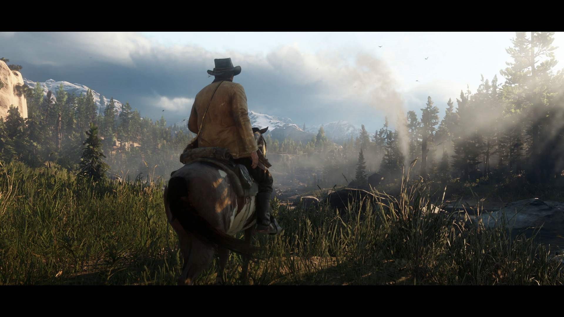
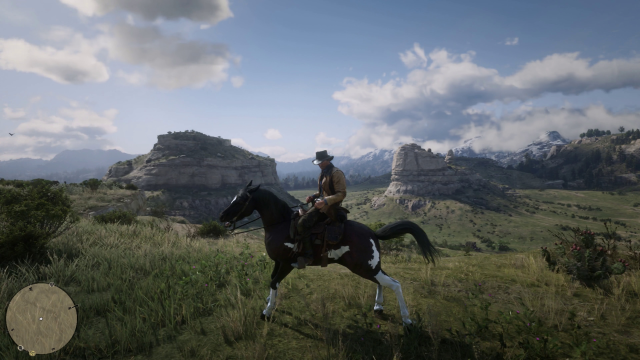
Not sure if anyone mentioned it, I think this is Horseshoe Overlook with Painted Sky in the background:
The rock formations are similar to the S-bend area and it looks like the river bends around on the right side going away from the camera. Plus Horseshoe = caravan camp which is what we see.
-
2
-
-
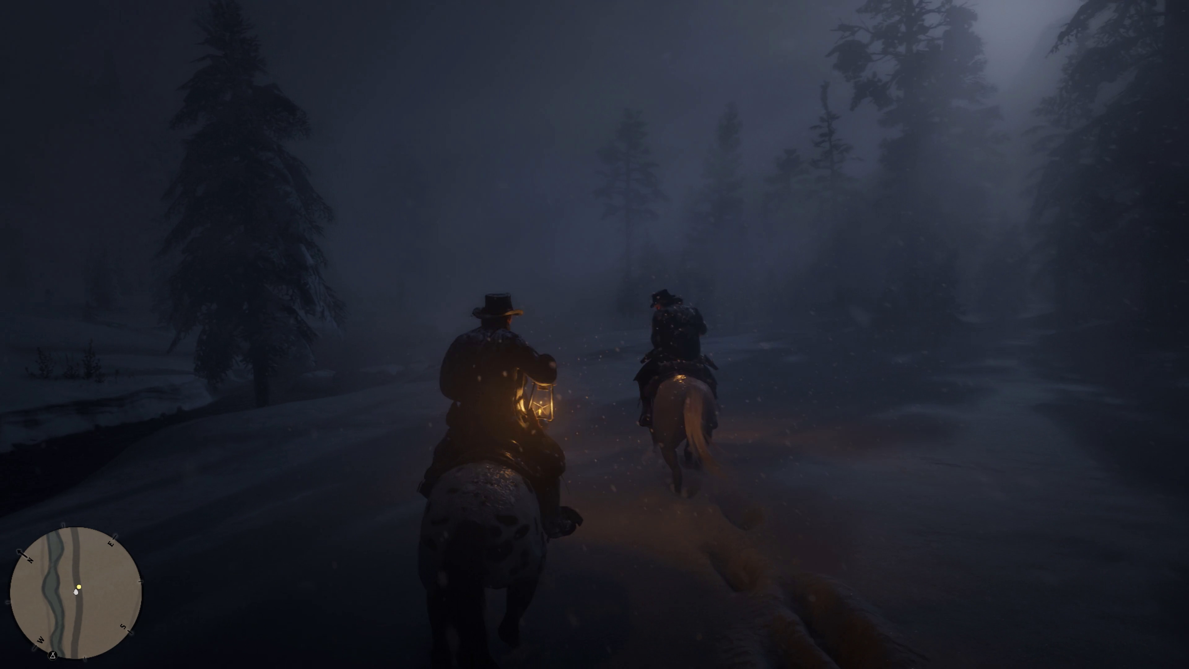
12 hours ago, ViceMan said:I would say the snowy scene with Dutch talking about feeding and keeping the people warm would be somewhere near Colter, I think that's where we'll be starting the game and possibly our first hideout, since the map says (Intro.)
I thought I mentioned it in this topic but can't find it now. I think the snow scene is from the northeast part of the map north of Brandywine Drop due to the angle of the river, it's small size, and the path/trails next to it as shown in the minimap:
The leaked map cuts off the top so who knows how much farther the little river goes. I assume 1 more grid square tall.
RE: Forests... I wasn't bothering since most have no background elements to link to other things (not even mountain tops). I just assume pine trees = Big Valley/Cumberland, swamps = Bayou/Thieves Landing
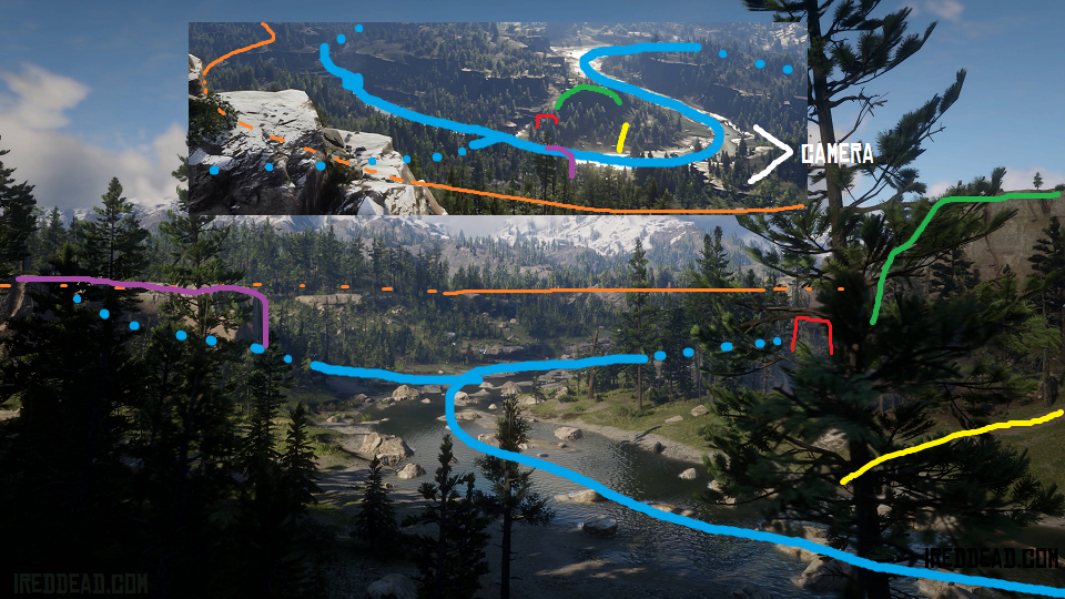
@Dup: This is the S-bend again. I can see the dead tree trunk and stump next to the smoke column:
^dead trees are red lines
As for this scene...
Not saying you are in the wrong area, but the camera angle you marked out does not line up with the rail line since it should run towards the left of the pic you have.
mspaintexampleinbound...
^Assuming this is a sunRISE, that makes the top north. Given the terrain and rail angle, I would put this pic over near Dewberry Creek. In the pic with the train you can see overhead wires cross the tracks. Perhaps in the area of the road on the leaked map.
-
1
-
-
9 hours ago, DuPz0r said:https://i.imgur.com/AO7u9DD.jpg
Amberino? New territory?
New Austin now too. So I guess they actually put in the rest of the old map (or at least the US side).Vicey said it already... anyway...9 hours ago, DuPz0r said:Any chance you can do your web magic and pull the highest res image off the newswire Fitty?
That's usually you guys... I just found the video files.
These are the links in the webpage coding. No sign of constraints in the URL so I assume these are max size...
-
1
-
-
Basically same for me. We mapped pretty much all we can. Most of it is the same places from different angles. The places we haven't nailed down don't have enough angles to link them to anything else.
-
Didn't see anyone talk about this shot yet:
Doesn't mean a whole lot but I'm trying to narrow down screenshots/caps we haven't linked to anything yet.
-
2
-
-
I think that was the issue with the pagination. I found a setting for that and turned it off. I can't find anything about the media-embed-thing aside from being able to toggle auto-embedding on/off.
-
You can still attach and copy/paste (rich text, basically) pictures. But posting a link will not automatically convert and embed it.
-
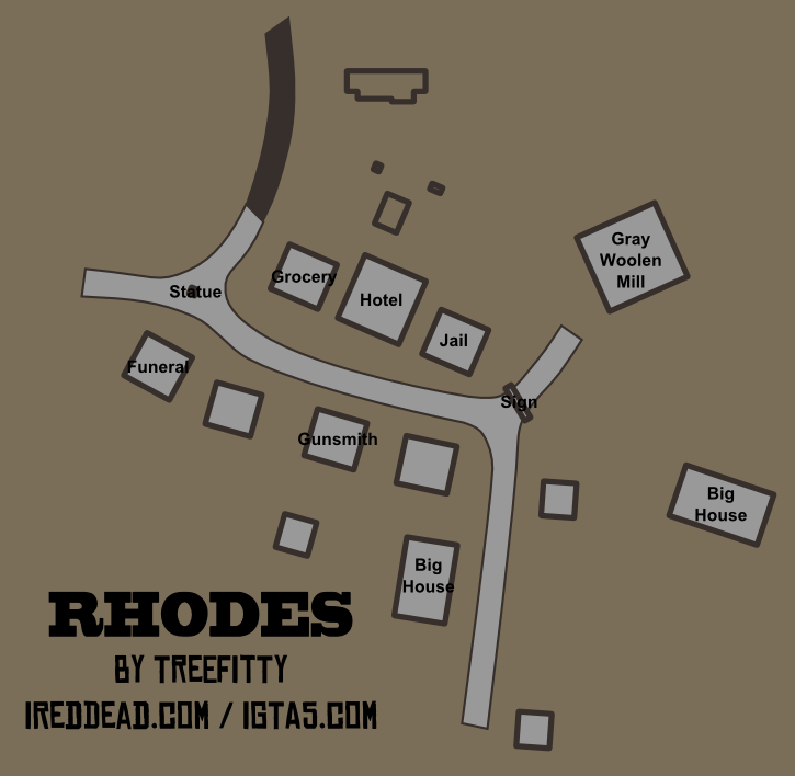
Minor updates to Rhodes and Van Horn...
-
2
-
-
I was waiting for the 3D mapping to happen.
-
1
-
-
It's a problem with the forums/IPB. I think the "app" or whatever IPB calls it for the auto-embedding is fucked up but I have no way to check the coding for that.
Also there is another update due for the forums but Psy isn't sure how its going to go since the last update did not go smoothly. Which might be part of the other issues as well.
-
^ I think that shot is "Valley View" or similar. South of Little Creek. Makes more sense to me using that big S-bend we talked about with Downes Ranch as a reference point.
-
1
-
-
I was starting to form an argument for it being Watsons Cabin, then started looking at the other creek/river south of Little Creek, but came back to Hanging Dog.
^I was going with the bump out in the middle as a reference point which the more southern creek has but at the very end. And then the rest of the northwestern curve wasn't there but Little Creek has that. So I'd say the bump out was not included on the leak map and the abrubt L bend under hanging dog on the map is as shown in the pic with the bottom cut off by the rock ledge.
-
I was trying to link that bottom pic to Mossy Flats and then Roanoke Valley area but the river/creek bends weren't quite matching up as far as I could see. I'm thinking Roanoke Valley with the island off Van Horn in the far distance. THe river bends just changed since the leaked map was made.
-
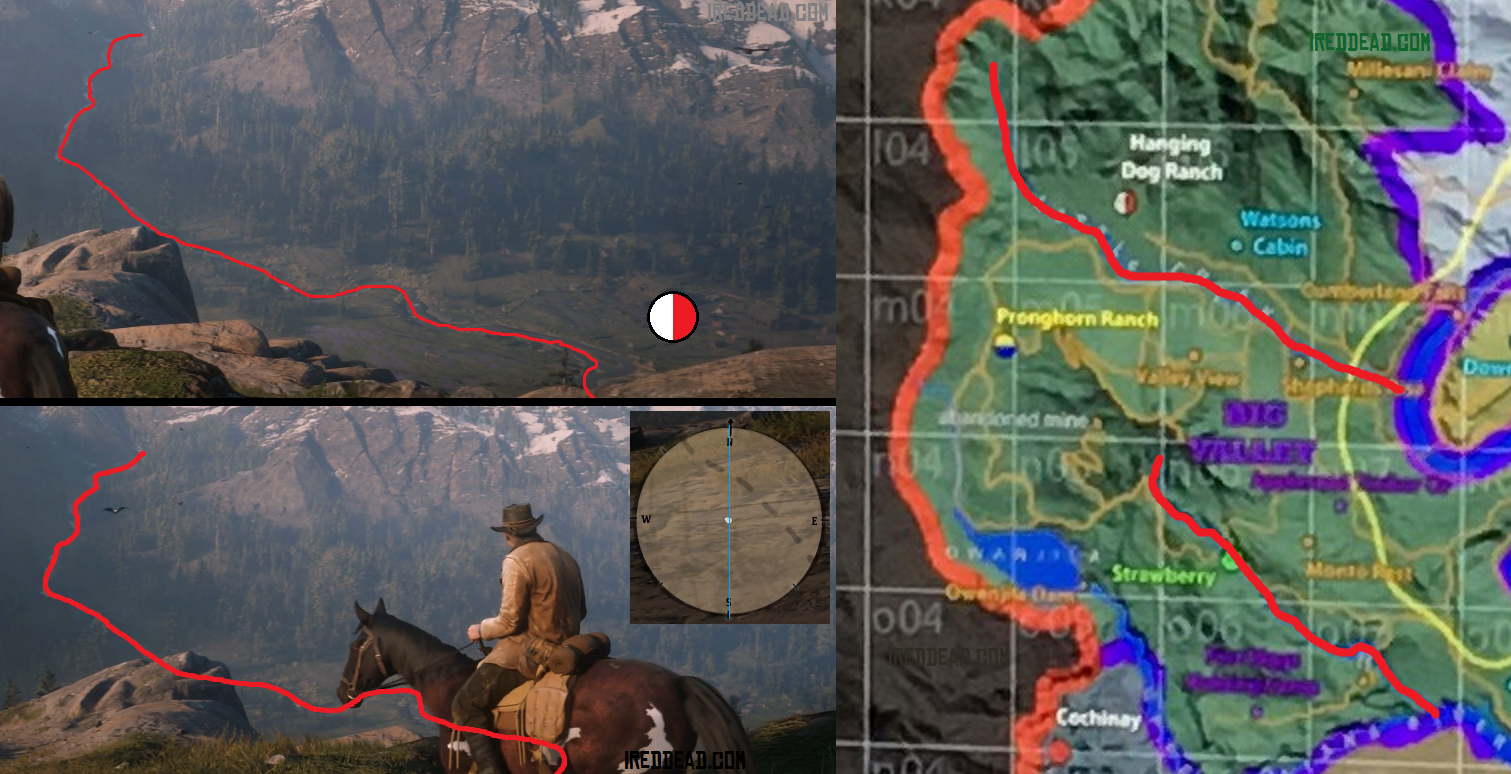
Now that really throws things through a loop with regards to the desert pic since it's mountain line is seemingly opposite of what the Great Plains pic shows...
And on the subject of random little things I believe this pic is from the northeast corner of the map near Brandywine Drop based on the angle of the river with the road/trail next to it as shown in the minimap:
-
1
-
-
As much as that RDR minimap looks like a good match, the direction is completely off (note the North arrow is top-right).
BUT... if we go with the RDR direction, that would put the range along the west part of the map. Since the desert pic is more stretched out that would tell me the desert is more north than the Great Plains - much more. Which would put it more in line with the Heartlands......
(and this hinges on Rockstar actually keeping the same mountain shapes from the old game, which I would think to be difficult but a fun way to really connect the two games)
-
11 hours ago, DuPz0r said:Fitty, mind if i integrate your town maps on my map, in a similar way that i added Saint Denis?
Hell no!
(yes of course)
RE: Desert pic... They are similar but not quite. Tried the 'ol cut out one, flip it, lower opacity, and compare over the other trick. Didn't look promising.
-
3 hours ago, ViceMan said:Makes the map scale seem pretty small if it's that close to the railway.
I started thinking the same thing but I think it will seem bigger in-game. When comparing the leaked map it definitely seems smaller but icons/locations may not be too accurate. More like placeholders.
I think this is more accurate as far as the rocks near Valentine. Small rock might be a little more south now that I look at it. I also traced out the "trails" in black to show them more easily:
The horseback fight/chase scene is the "road" north of the blue mound. The radar shows they are on a "road" in that shot. The "trail" under the big rock can be seen in this shot below. There is even two wagons passing each other background-right next to the horse's tail:
-
2
-
-
^Nice
Updated Valentine Map:
-
1
-


RDR2 Mapping [Interiors & Out of Map inc.]
in Red Dead Redemption 2
Posted · Report reply
Just linking these.....
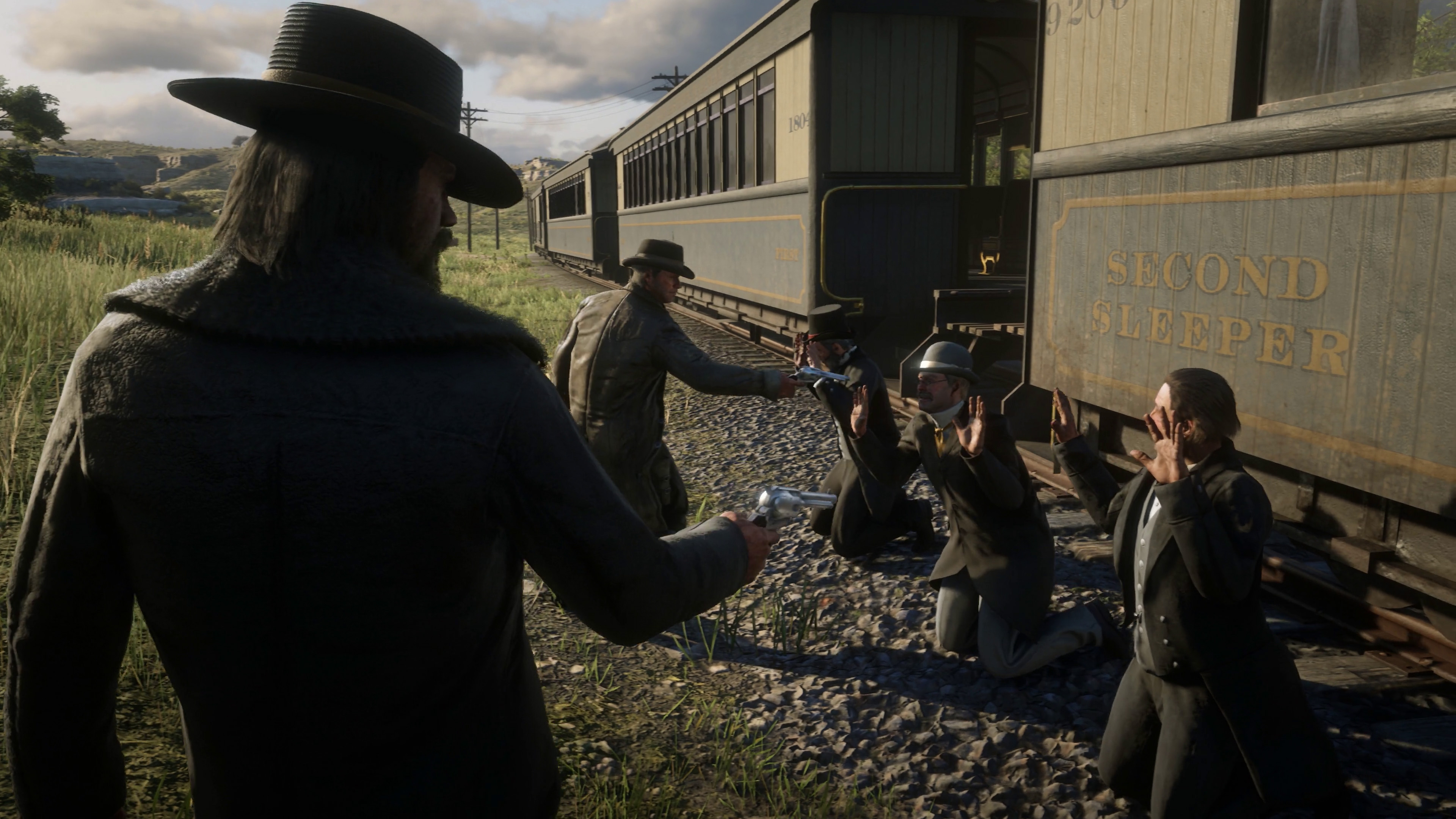
Train robbery just south of Valentine:
^I think this is that road we see in the radar of this next shot:
^There are two poles "double up" in the previous pic (center) which may be this crossover point for the wires.
^Note the tree next to the horses on the right. You can see this tree in all the previous pics.
^Note what looks like the barns in the background left of Arthur's horse (this is from trailer 3 if you want to go to different frames) and the mountain peak. You can see the pole crossover again on the left. Also note the train is going the opposite way from the IGN screenshot.
This is the S-bend area I pointed out previously with other shots:
^The rocks on the left behind the trees are the ones in the background of the bear pic.
^I assume this is somewhere nearby but can't find a good match for the rock formation the moose is on top of. The layered rocks are similar to the waterfall area.
These two have the same ruins on the left of each:
^Right above Dutch's head
Still doesn't put an exact location on it but something to think about.